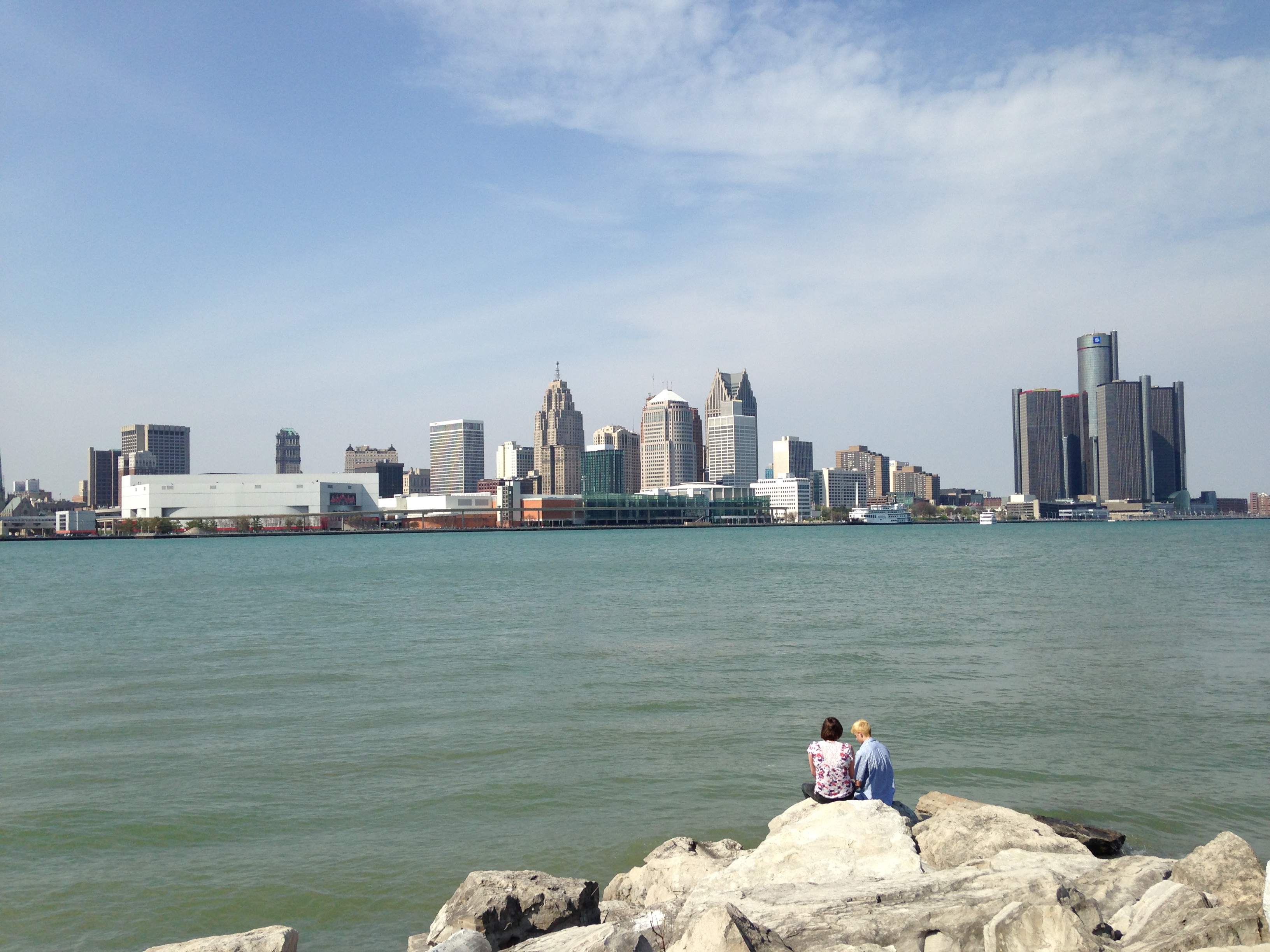
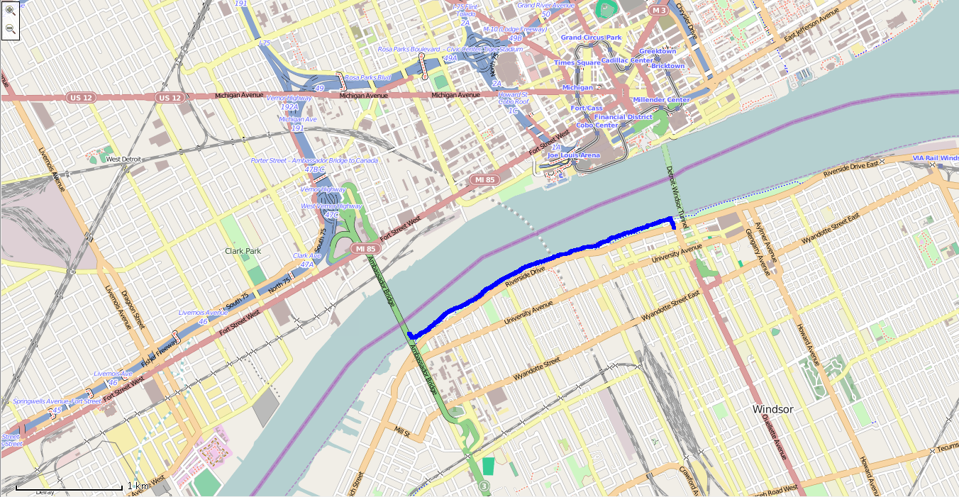
Track: Detroit River

User: TracingTracks
Location: Windsor, Ontario, Canada
Distance: 3.1 km
The Detroit River is the border between Windsor, Canada, and Detroit, USA. This track runs between two crossing-points: the Ambassador Bridge and the Detroit-Windsor Tunnel.
Date: 08 May, 2014
Traces of Detroit River
Add A Trace-
Trace by: Germaine
Location: Iona Beach spit, Vancouver
Distance: 8.8
A neat feature in Vancouver, this 4.4km human-made spit extends straight out into the Georgia Straight from the mouth of the Fraser River.
Date: 03 August, 20150 -
Trace by: Germaine
Location: Toronto, Ontario, Canada
Distance: 2.6 km
I did this one from memory, remembering that the track had two short spurs and a gentle curve, though I didn’t remember the direction of the curve. I simply followed the shoreline, only straightening my path at one end. On my trace, one spur records me getting across the highway to the lakeshore, and the…
Date: 10 May, 20141
Trace this track: Detroit River
Either use your current location, or enter the decimal coordinates of your desired starting point. If you are using a mobile, make sure your Location Services are enabled.
Because GPX data uses a specific location, we have a built-in GPX converter that will map the Track to your desired start location. Either use the simple "Detect My Location" option, or enter your latitude and longitude, using positive or negative decimal numbers (eg. Rio de Janiero at 22° 54' 0" West and 43° 12' 0" South would be -22.9 and -43.2). If you are on a mobile and logged in, we can email the GPX track directly to your registered email address.
For more information how to find your coordinates, please see our HOW TO.